 Beginning in 2001, hundreds of commercial fishing vessels on the Northeast Shelf have had oceanographic sensors installed on their fixed and mobile gear. Some have experimented with pressure sensors, acoustic listening devices, cameras, satellite-tracked drifters, current meters, and salinity monitors but the primary focus has been monitoring temperature. While some gear are fitted with internally-recording devices that have returned more than two decades of hourly data from fixed locations, most of the vessels are now fitted with a satellite transmitter and, most recently, with cell phones so that tens of thousands of hauls have been reported in realtime since 2015. The original focus was on bottom temperature but, beginning in 2020, most vessels are now equipped with water column profilers to document the vertical stratification of temperature and several are collecting records of dissolved oxygen.
The primary goal is to feed the data to both ocean models and stock assessment models.
The collection of eMOLT information is authorized under the OMB Control Number included in the Citizen Science & Crowdsourcing Information Collection page.
While the project was initiated at NOAA's Northeast Fisheries Science Center in 2001, the Gulf of Maine Lobster Foundation leads the administration/operations along with several partners.
The data is served in a variety of ways. To access the historical data from fixed locations click here, for the realtime data here, and for those with dissolved oxygen here . With some help from our partners at the Commercial Fisheries Research Foundation, the data is also available in a gridded format here.
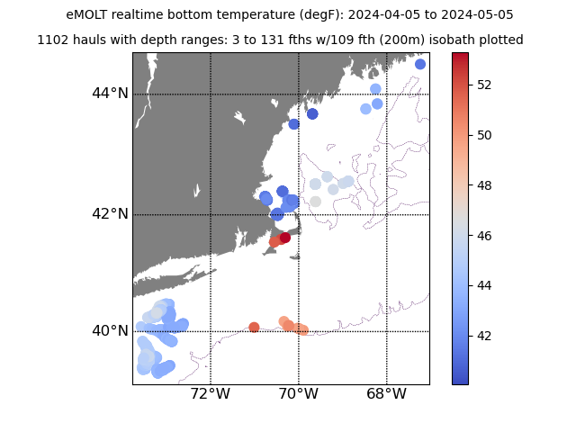
To see a map of bottom temperature observations from the last month, click here.
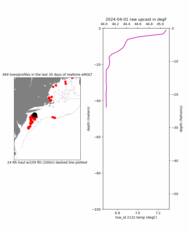
To see an animation of raw temperature profiles from the last month, click here.
To see a sample of some news releases, click here.
To sign-up to see your detail data on private account, click here.
To see instructional videos on several related web portals, click here.
Funding comes from a variety of sources over many years including:
For more information on the project, how to get involved, how to get a weekly update, what instruments are used, and where to find the data, contact george.maynard@noaa.gov.